
Spatial Big Data
Clients
Solutions
Technology
About Us
Surface Deviation Mapping (SDM):
We currently measure floor surfaces...
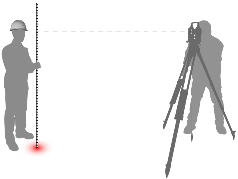
by manually taking
measurements every
5 or 10 feet...
This method at best samples less than .001% of any surface.
But now...
Surveyors have new tools that capture at least 100,000x more measurements a second...
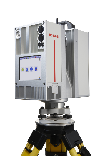
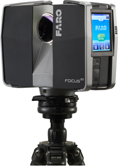
Our software accepts pointcloud datasets from any high density laserscanner.
Laserscanners can measure up to 99% of any surface:
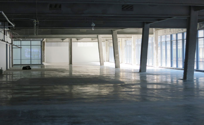
site photograph
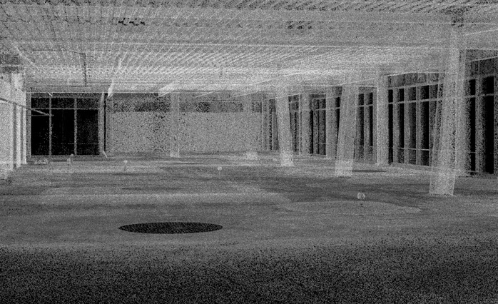
3d perspective view of raw photocloud displaying over 8 million measurements.
Yet this data, up until now, could not be visualized by conventional surveying tools and methods.
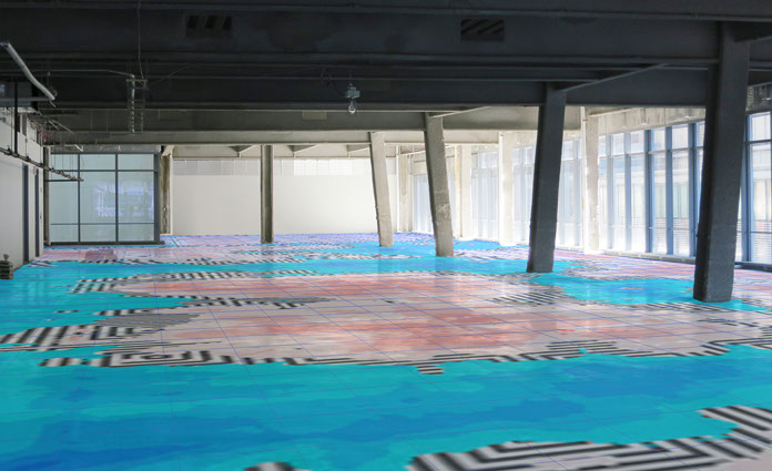
Raw low-res SDM output overlayed on pointcloud and site photograph.
Hypsometric designed its code to handle billions of measurements to leverage this rich big data source.
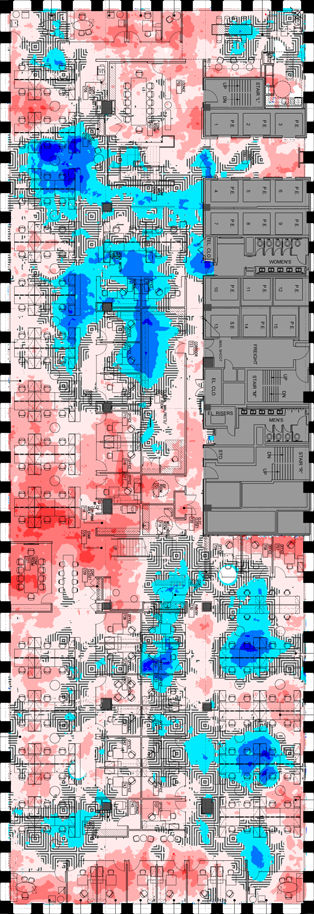
Then we designed a cartographic rendering engine to visualize these large datasets accurately.
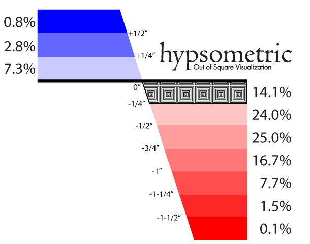
Our double-ended, multipe-hue scale graphic representation allows you to see elevation relationships at any size in seconds.
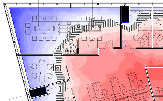
Every hue shift denotes 1/4" of an inch. The bluer the higher, the redder the lower. Pattern denotes 00.
Our graphics representation allows us to overlay your future designs right on top of the SDM map with some alignment help from our LDM engine.
Using our take on the SLAM algorithm we find the best fit between reality and your existing drawings.
© Hypsometric, LLC. All rights reserved.